SNPWG Members Participate it the BLAST Project Development Work.
 

Harmonisation of Nautical Information

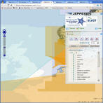
Five SNPWG/BLAST members worked to integrate nautical publication content into nautical chart formats, based on the data model developed by the IHO's SNPWG (Standardisation of Nautical Publications Working Group). Click here to download the report on the Harmonisation of Nautical Information.


J
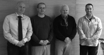
ens SCHRÖDERFÜRSTENBERG (BSH-Germany), Pelle AAGAARD (KMS-Denmark), Olav HAUGEN (STATKART-Norway), Eivind MONG and Raphael MALYANKAR (Jeppesen) participated in the BLAST Work Package 4 - Navigating the North Sea.

The "Navigating the North Sea Work Package" was intended to provide opportunities for hydrographic offices, coastal authorities, industry, and mariners to participate in this work, and to contribute to improving information services in the North Sea region. It also provided an opportunity to test IHO standards, and provide practical feedback on their implementation.
 

The worked was based on the SNPWG data modelling efforts, and resulted in several outcomes that will be of interest to Hydrographic Organisations. These include;
 
  • Report on Nautical Information Management. This report analyses how information on conditions at sea, chart inconsistencies or nautical publication updates flow from users in the field to responsible national agencies. The report can be downloaded from the BLAST >  North Sea Work Package > Results page.
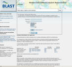
  • Maritime Data Collection System. This prototype system (based on the report above), enables users to enter information on conditions at sea, chart inconsistencies or nautical publication updates in a shared, structured system. It is intended to provide a single-point-of-contact for mariners to contact national authorities, also across national boundaries. It is also intended to provide national authorities with a simple tool to ensure that enquiries are properly directed to the correct authorities.
     - Visit the MDCS here
     - Read the MDCS report
  • The 3D Port Model integrates topographic and hydrographic height data to provide a new approach to nautical navigation. The concept is based on studies that show increased mental processing time for the use of north-up and heads-up chart displays.  The report can be downloaded from the BLAST >  North Sea Work Package > Results page.