IHO GIS
IHO GIS
CHART Project
| The Cartography, Hydrography and Related Training (CHART) Project is an education programme for nautical cartography and data assessment run under the partnership between IHO and the Nippon Foundation. This service provides the geographical distribution of the Alumni having graduated from the training course conducted at the United Kingdom Hydrographic Office. |
|
| Le projet « cartographie, hydrographie et formation associée » (CHART) est un programme de formation relatif à la cartographie marine et l’évaluation des données conduit dans le cadre du partenariat entre l’OHI et la Nippon Foundation. Ce service fournit la répartition géographique des stagiaires qui ont suivi avec succès la formation dispensée par le Service hydrographique britannique. | |
- Details
Maritime Spatial Data Infrastructure / Infrastructure de données spatiales maritimes (MSDI)
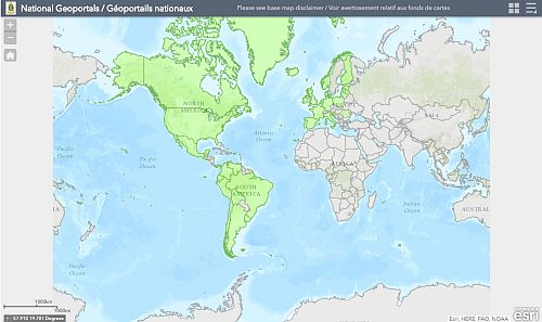
| States with known MSDI and/or other SDIs are represented in green. The list of SDIs is provided as a pick report which contains the links to the SDIs. |
|
| Les Etats qui ont une MSDI et/ou d’autres SDIs sont représentés en vert. La liste des SDIs est fournie par un rapport d’objet contenant les liens vers les SDIs. | |
- Details
GIS / SIG
| IHO Geographic Information System | Système d’information géographique de l’OHI |
| Country Information System | Système d’information sur les pays |
| Regional Information Systems | Systèmes d’information régionaux |
| Chart Information Systems | Systèmes d’information sur les cartes |
| Capacity Building Information | Information sur le renforcement des capacités |
| World Bathymetry Information | Bathymétrie mondiale |
- Details
CIS
Country Information System / Système d’information sur les pays
|
|
||
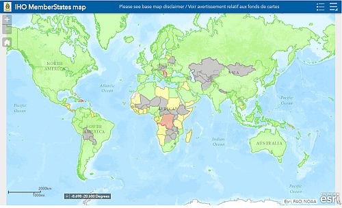
| IHO Member State xx Etat membre de l’OHI |
||
| Suspended Member State Etat member suspendu |
||
| Non-member coastal State Etat côtier non membre |
||
| Non-member landlocked State Etat enclavé non membre |
||
|
For more information / Pour en savoir plus |
- Details


